Due to some delayed downlink of images, we didn't receive all the information we needed in time to do contact science today. Although the data did eventually arrive, it was too late to allow us to get the arm out for contact science. Each planning day has a very strict timeline, in order to make our scheduled uplink time, which is MSL's allotted time for using the Deep Space Network to get our plan up to the rover. Planning contact science targets takes most of the first two hours of work on any given day, so the three hour delay before the data was processed would likely have resulted in us missing our uplink slot – a rare occurrence for the super efficient MSL team, and one we aim to avoid at all costs!
So instead, we decided to make it an imaging day, and lean heavily on the Mastcam and ChemCam teams, characterizing the area around the rover and beyond. Mastcam will take several small mosaics (e.g., 2 rows of 2 images, or 2 rows of 4 images) and ChemCam will use its Remote Micro Imager (RMI). On the far right of the workspace, Mastcam will image "Tacuiquene," a block with nodules and laminations, which seems to be a float from along our future drive path, so we will get a taste of what is to come. There are a lot of vein features in this area, so both ChemCam and Mastcam will be looking at these. Close to the rover, ChemCam is using LIBS to analyze some of these raised veins at "Jauaperi" which will also be imaged by Mastcam. Just above this, Mastcam will image the strata or layers in the target "Cauame." Further afield, Mastcam will image a large vein feature at "Los Azulitas" and reimage the veiny target "Cano Macareo" from a slightly different, closer perspective than the previous mosaic.
A small grey float "Cerra Duida" will get the most attention today – ChemCam will image this with the RMI (which gets very detailed images from a distance), take a "passive" measurement (i.e., not using the LIBS laser), and Mastcam will take a multispectral image of the target. We have analyzed quite a few of these grey floats in recent weeks, and the team is interested in learning more about them.
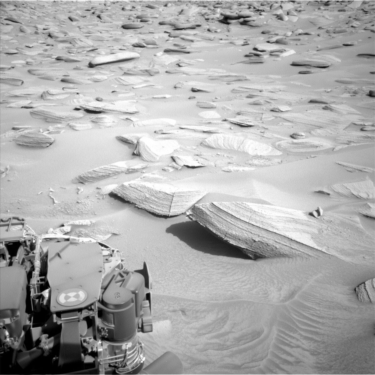
Our drive today will be a relatively short one (20 metres or so). The driving in this area is slow going. Rather than regular flat bedrock, we are facing rocks sticking out from sand patches with float stones loose on the surface (see the accompanying image). Some of the bedrock slabs here also move when driven on, such as today's Mastcam target "Nosan Mountain" – providing quite the obstacle course for the rover planners to pick through.
Written by Catherine O'Connell-Cooper, Planetary Geologist at University of New Brunswick-Cooper
from NASA Mars Rover Curiosity: Mission Updates https://ift.tt/jKgPfUm

Comments
Post a Comment