Earth planning date: Wednesday, October 2, 2023
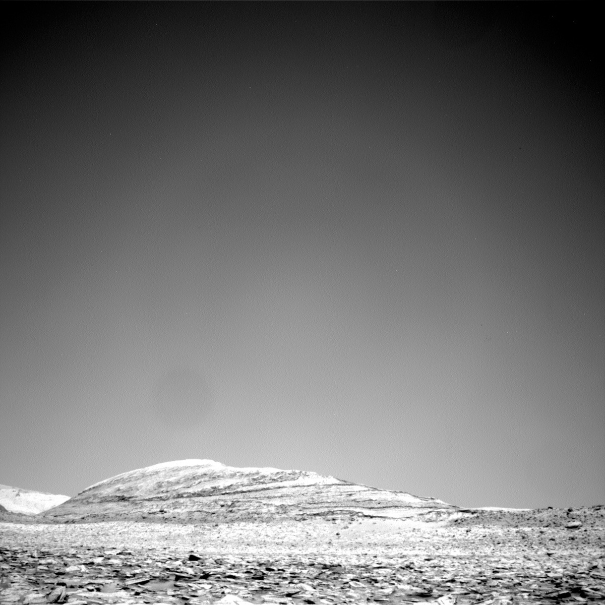
HiRISE images of Gale crater show that Curiosity is driving through a section of layered rocks on Mt. Sharp, and the layers consist of alternating bands of light and gray/dark rocks. What causes the color variation of these rocks that makes this terrain look banded from orbit? It may relate to differences in the composition or chemistry of the rocks; alteration that occurred after they formed; how the rocks within each band are eroding; or varying amounts of sand cover. As she drives uphill, Curiosity uses her suite of instruments to study the chemistry and texture of the bedrock to determine the nature and origin of this banding.
The plan for sols 3966 and 3967 included further analysis of light rocks, a drive, and post-drive imaging. Curiosity will use the dust removal tool (DRT), MAHLI, and ChemCam to characterize the bedrock at 'Burnt Mountain,' and the adjacent 'Bearpaw Meadow' target will be analyzed with DRT, APXS, and MAHLI. ChemCam LIBS will assess the chemistry of 'The Watchtower' target, a smooth layer on the larger 'Coyote Flat' bedrock, in addition to a resistant layer at the 'Sky Meadows' target. ChemCam also planned two long-distance RMI images: one will capture the Peace Vallis fan-shaped deposit on the distant crater rim and the other will take a closer look at the boulders and bedrock within the upper Gediz Vallis ridge.
Mastcam also has a full slate of activities in this 2-sol plan. Not only will Mastcam document the two ChemCam LIBS targets, Mastcam will also image the disturbed terrain and residual layers on a nearby bedrock target called 'Slim Lake,' and a fragmented rock to assess mechanical weathering. Looking uphill, a Mastcam mosaic will document the bedrock in front of us to characterize the gray/darker rocks that make up the next interval band. After Curiosity completes her short drive on sol 3967, Mastcam will document the workspace and the future drive direction, and during the drive we planned a 'clast survey' to assess the accumulations of pebble-sized rocks covering the ground.
Finally, ENV included a large dust devil survey and a Mastcam 'tau' observation that images the Sun to measure the amount of dust in the air. I am looking forward to seeing our workspace on Wednesday as the rover continues her climb along the Mt. Sharp ascent route!
Written by Sharon Wilson
from NASA Mars Rover Curiosity: Mission Updates https://ift.tt/b37jSIf
Comments
Post a Comment